------ Services ------
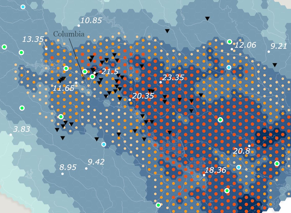
Good GIS begins with people. Freewheel Maps offers a full suite of geospatial services in Columbia, South Carolina and beyond, with a focus on helping people get the most from their GIS technology.
- Geospatial Strategy and Planning
- Spatial Analysis and Modeling
- Data Collection from Field to Information
- GNSS and GPS Mapping
- Web-GIS and Public Applications
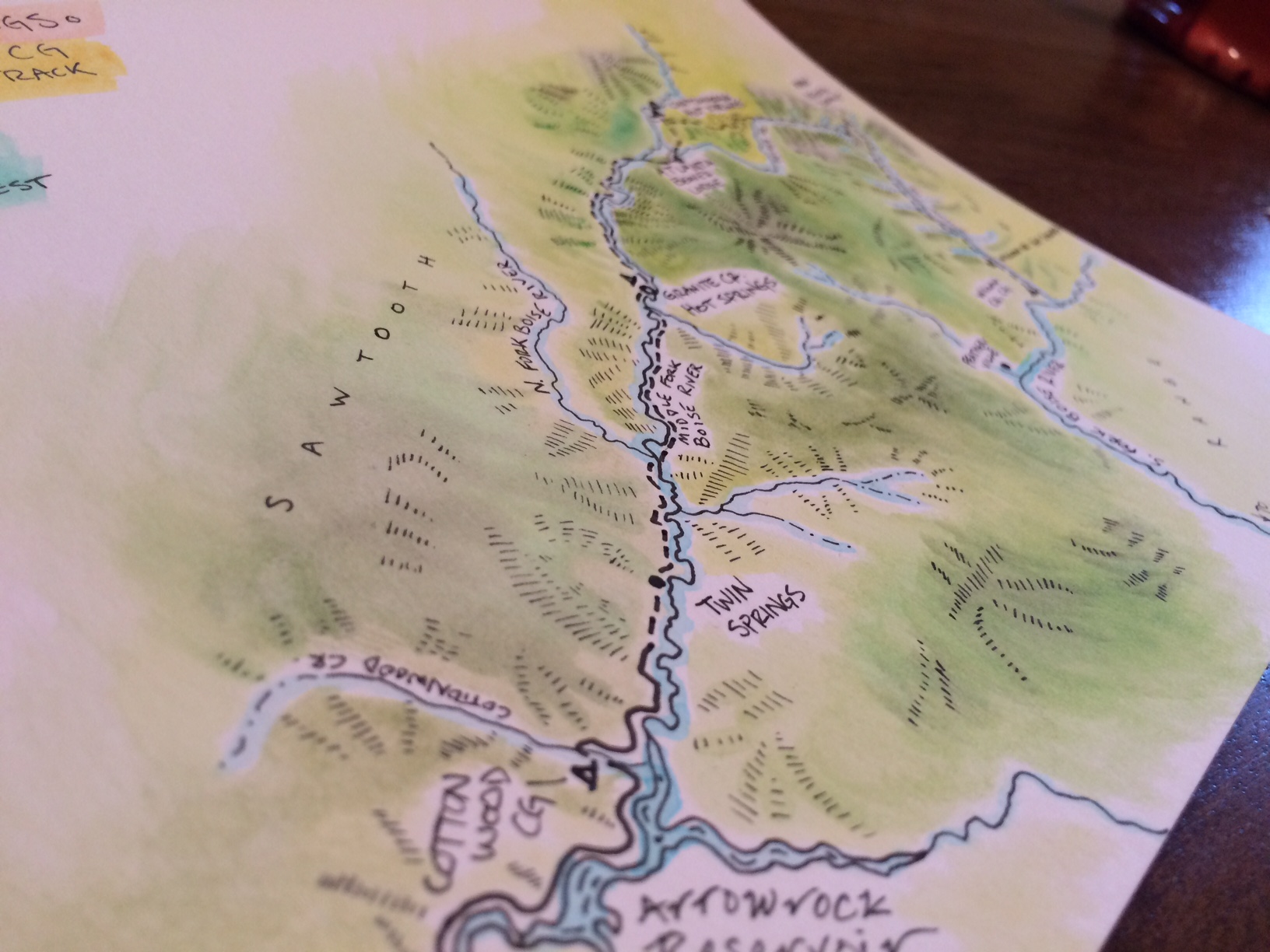
- High Quality Cartography
--- High Accuracy GNSS ---
Freewheel Maps is a user and official seller of Eos Positioning Systems GNSS recievers. If you are collecting data where accuracy matters, Eos has the most reliable and user-friendly units on the market.
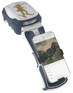
- Submeter to centimeter accuracy with RTK.
- Bluetooth to any device.
- Works with Esri apps, plus many more.
- Integrates with other instruments.
- Top-notch support.
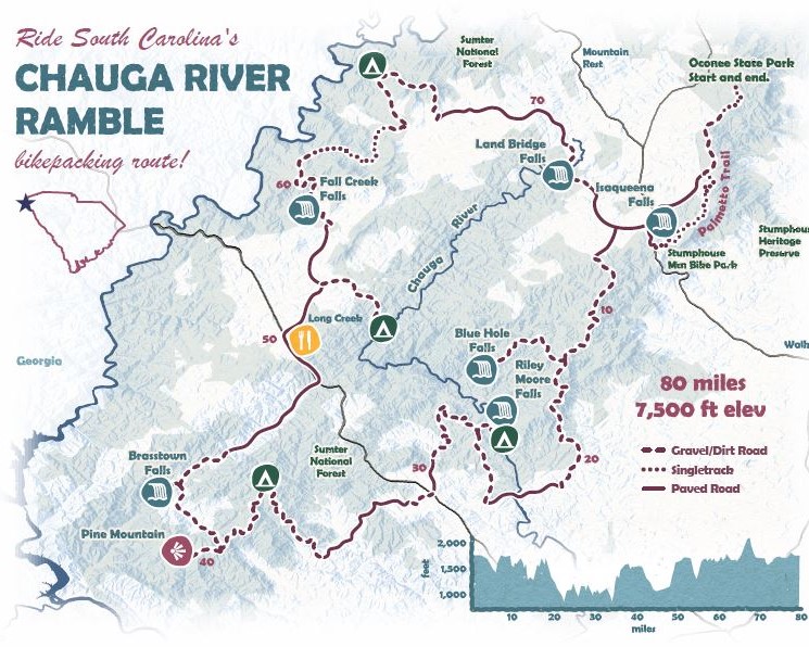
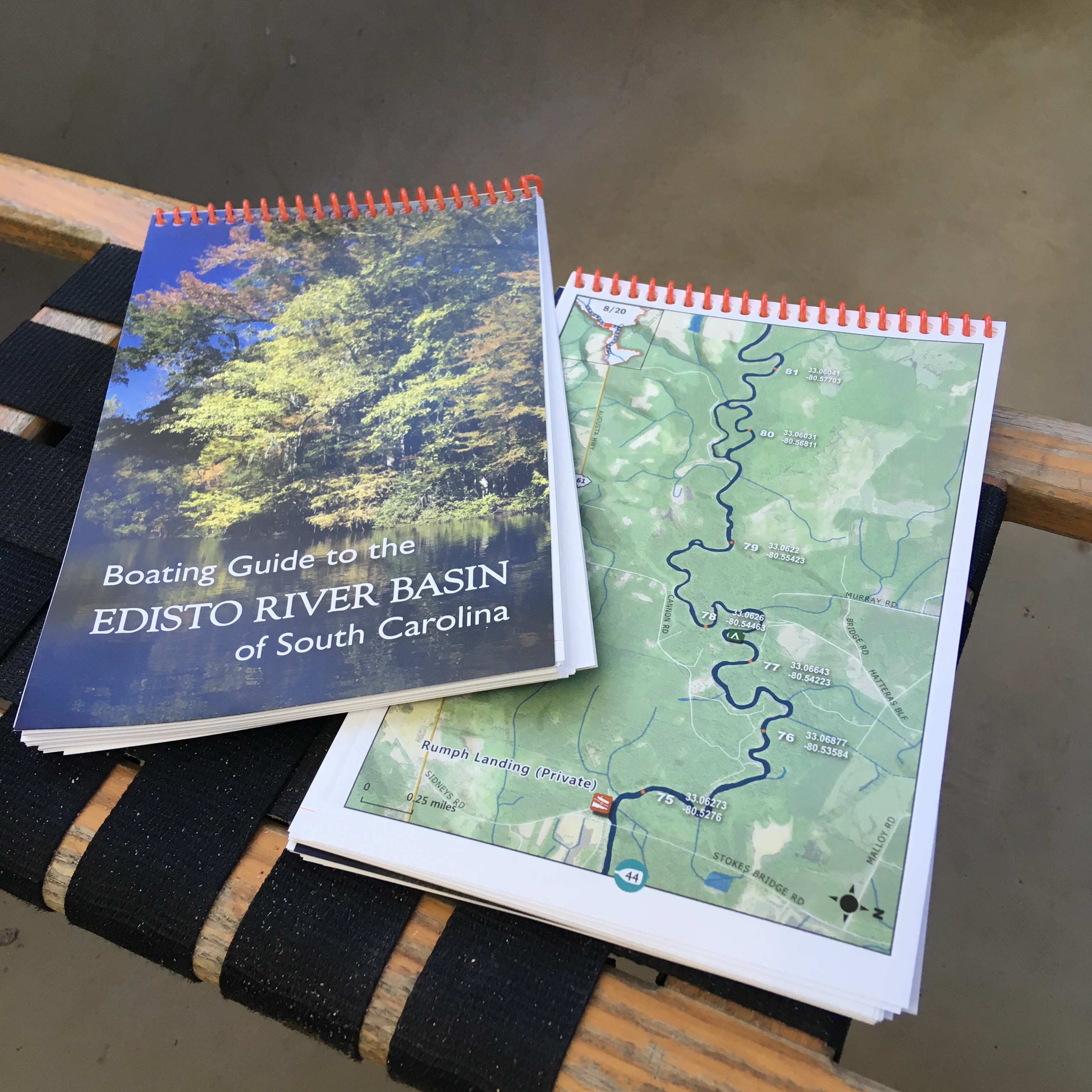
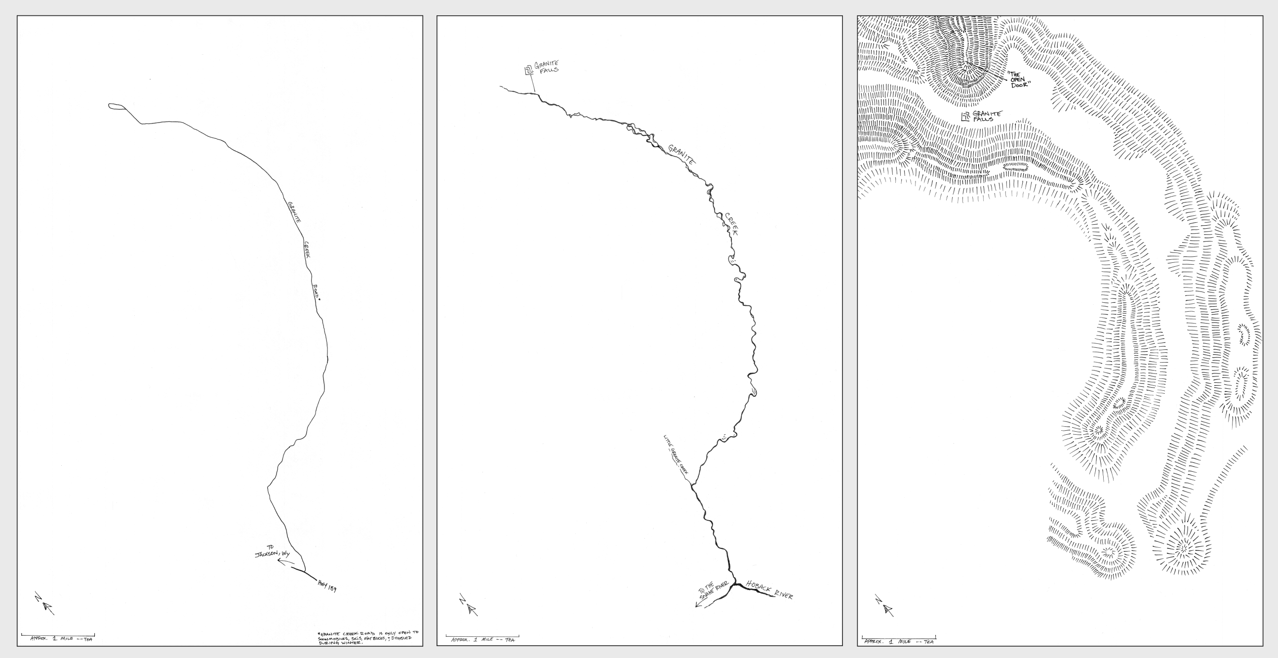
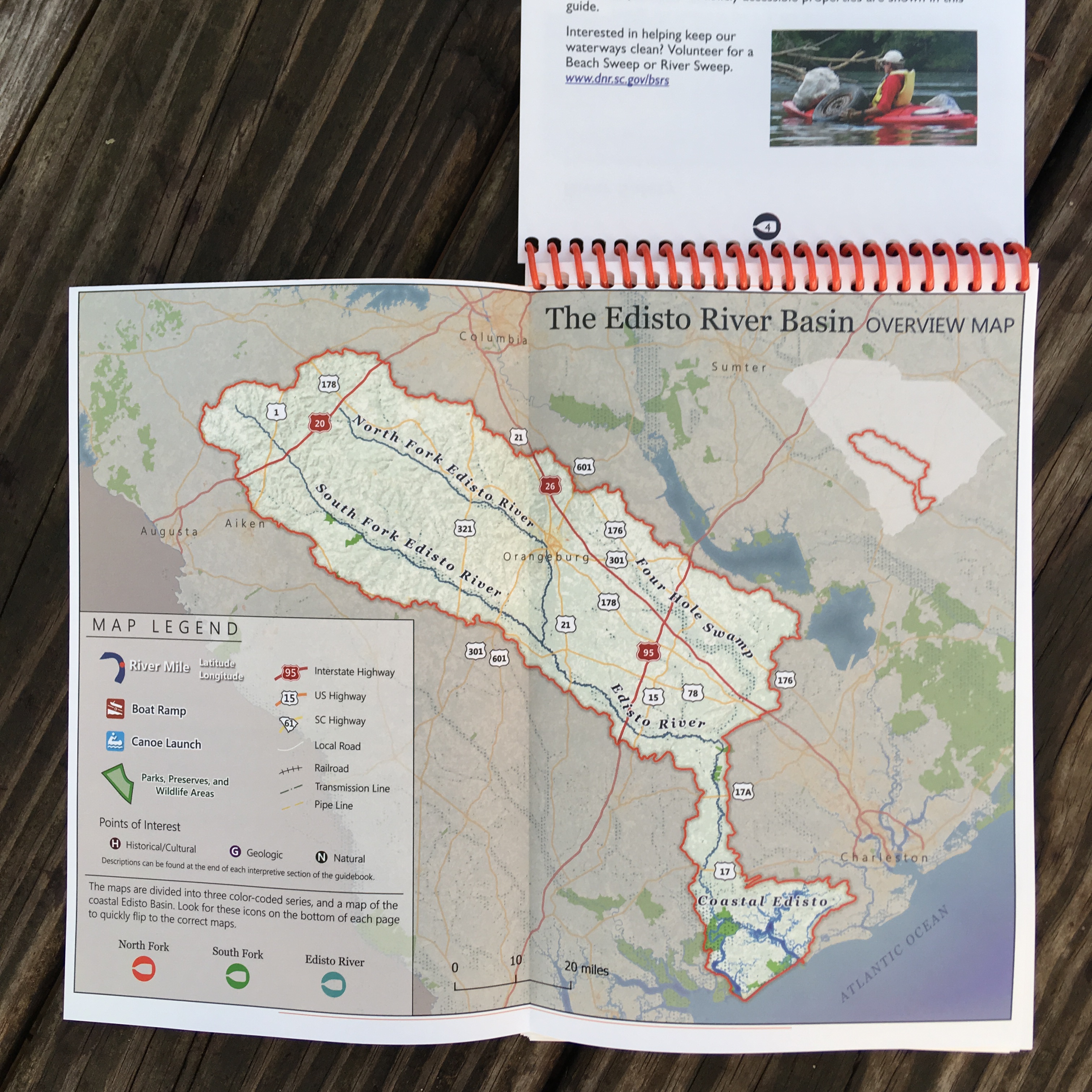
------ Maps ------


------ About ------
Tanner Arrington | Columbia, South Carolina
I spent the previous decade as a GIS Manager for the South Carolina Department of Natural Resources.
I like high quality cartography, scripting with Python, and modeling GIS workflows. I've worked in just about every corner of Esri's ArcGIS platform, and also with QGIS and other open-source tools.
I collaborate with the great folks at Community Geographics.
If Freewheel Maps can help your organization or company with GIS, please send me an email to get in touch:
.